
EUROPEAN EYES IN THE SKY
Imaging Notes - Fall 2006
World Security Institute Center for Defense Information- Washington, D.C.
A quiet revolution is happening in Europe. While Europe long has been a player in the global space game, European activities traditionally have focused on the civil and commercial uses of space. Over the past several years, this focus has been changing as European nations have come to recognize the value space systems can bring to their military operations.
This change is driven in part by Europes efforts to create an independent Rapid Reaction Force for peacekeeping operations, but also by the realization that much of the U.S. militarys current battlefield edge comes from its use of space power. Movement, as is often the case in Europe, has been slow, but the shift in thinking is palpable and funding is starting to follow.
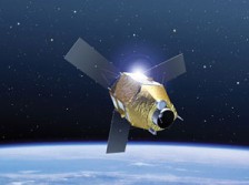
Nowhere is this revolution more obvious than in the field of remote sensing. At least 31 European remote sensing satellites are currently operating or are planned for launch by the end of the decade by individual nations, coalitions and/or by European nations collectively. Of that total, seven satellites are dedicated military assets, including a first ever German military reconnaissance satellite, SAR-Lupe. Another seven are explicitly dual-use, including Italys first radar satellite constellation, COSMO-SkyMed.
Examination of the technical capabilities planned for the remaining civilian satellite systems reveals that European militaries also stand to benefit from these programs. The new satellite networks would be able to provide vastly improved capabilities for mapping and targeting, reconnaissance, troop monitoring, ocean surveillance and weather prediction and raising a host of questions regarding future U.S.-European defense relations.
Pleiades will be a dual-use successor to France?s SPOT optical Earth observation satellite constellation. However, access to data from the two Pleiades satellites will be prioritized to military users with one of its advantages being the ability to take many images during one orbital pass, thus allowing rapid and detailed mapping of urban environments. The two satellites will be launched between 2008 and 2010 and will collect panchromatic data of 0.7-m resolution and multispectral data (blue, green, red and infrared) with 2.8-m resolution. Austria, Belgium, Spain, and Sweden are sharing the costs of the system in exchange for access to data.
Hélios. The first generation Hélios satellites, Hélios 1A and 1B, were launched respectively in 1995 and 1999. These had a resolution of about one meter and no infrared capability. Only Hélios 1A currently remains operational.The second generation program was begun with the launch of Hélios 2A on Dec. 18, 2004, into a sun-synchronous polar orbit. It carries a high-resolution camera and a wide field camera, each operating in both the visible and near-infrared spectra with a resolution that is classified, but estimated at about 0.5 meters for the high resolution camera.
TopSat is a program jointly funded by the British Ministry of Defense and the British National Space Center. It is aimed at proving that low cost microsatellites can ?provide high resolution images of a specific location in real time, a mobile ground station that can be taken to remote, off-road locations.? The microsatellite, launched in October 2005 into a sun-synchronous orbit, is capable of 2.5-m panchromatic and 5-m multispectral resolution. The year long mission will cost less than $25.8 million. The British military, which is interested in using microsatellites to provide intelligence, surveillance, reconnaissance and target acquisition directly to forces in the field, is considering a possible follow on program.
RapidEye. Although being built primarily for the commercial market in agricultural imaging and mapping, Germanys planned RapidEye constellation of five mini-satellites will also be used by the German military. RapidEye, to be launched in 2007, is expected to provide multispectral imagery with 6.5-m resolution (with a 77 km swath width).
GMES. Global Monitoring for Environment and Security System is a joint European Union, European Space Agency effort to enhance pan-European Earth observation abilities, in order to study climate change, improve mapping, monitor marine environments, provide warnings of natural and man-made disasters, and monitor borders. In addition, it is specifically designed to support the EU Common Foreign and Security Policy and the European Security and Defense Policy that govern joint European military operations.
The space segment of GMES will first involve integrating data from existing national and multinational remote sensing satellites and other sources, and between 2007 and 2012, will involve integrating five follow-on families of small satellites (dubbed Sentinels) into a unified net-work. While GMES has been politically approved by ESA?s member governments, the project has become bogged down in budgetary issues and political scraps about its future use and purpose.
DMC. Disaster Monitoring Constelation is a five-nation constellation of Earth observation microsatellites (in the 100 kg range) for mid-resolution, wide-area mapping to monitor and help manage natural and man-made disasters. Some in the U.S. have raised eyebrows over the collaboration between the U.K.-based Surrey Satellite Ltd. and China on two separate microsatellite programs, the Tsinghua-1 and the multinational Disaster Monitoring Constellation (DMC). The Tsinghau-1 project was both a training exercise for Chinese space scientists and operators and an experimental precursor to the DMC. Launched in 2002, ?the 50 kg microsatellite carried a medium resolution multispectral Earth imaging payload providing 30-meter ground sampling distance (GSD) in four optical bands (NIR, green, blue),? according to Surrey Satellites website.
No hay comentarios.:
Publicar un comentario